
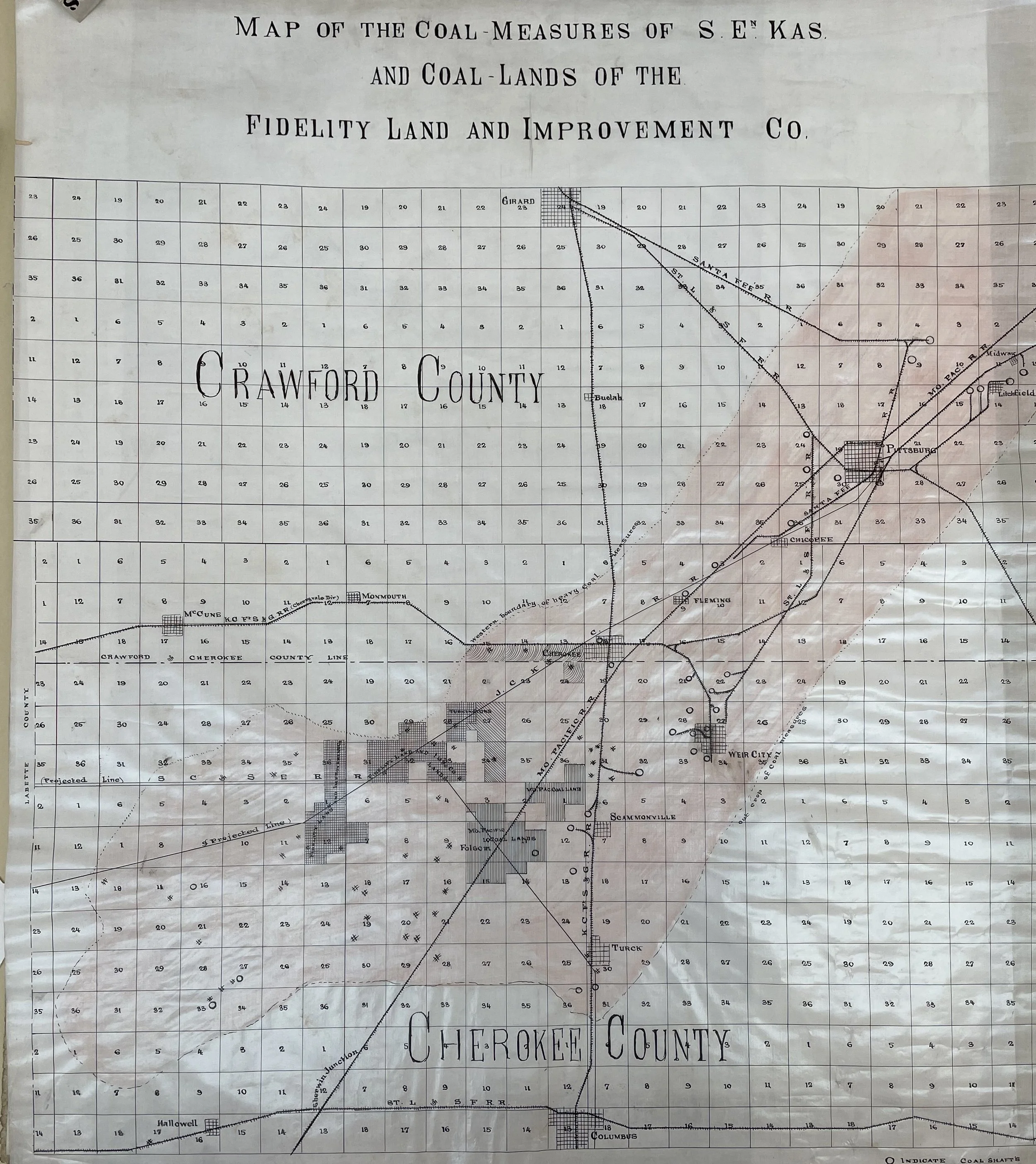
Fidelity Land & Improvement Co.
Here is a little gem courtesy of the Kansas State Archives (Archives - Kansas Historical Society). These are the coal measures of Fidelity Land & Improvement Co., which was owned in part by Robert Alexander Long of Long Bell Lumber Co. This image is likely from the early to mid-1890s given that…
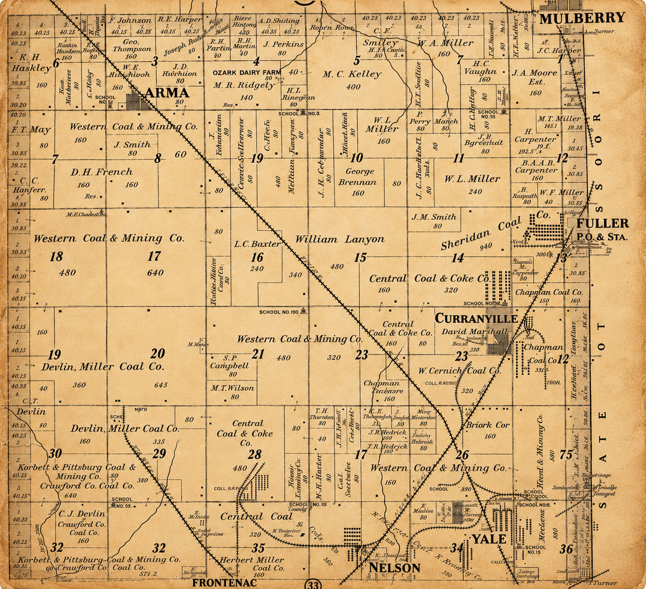
Railroads of Arma and Mulberry
Here is an image of the railroad lines running from north through Arma, Mulberry and Frontenac. Curranville and Fuller are also displayed. This image comes from the 1906 Plat Book of Crawford County and may be found here: 1906crawfordt29r25.jpg (1269×1481).
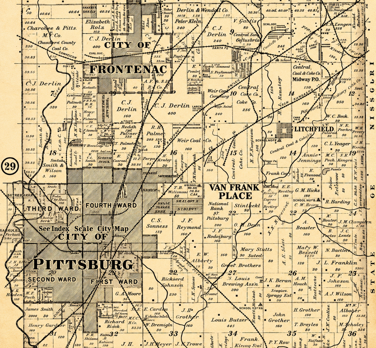
Railroads of Pittsburg and Frontenac
This image shows the lines coming into Pittsburg and Frontenac in 1906. The full image can be found here: 1906crawfordt30r25.jpg (1279×1391). Nearly every railroad line is featured in this image…
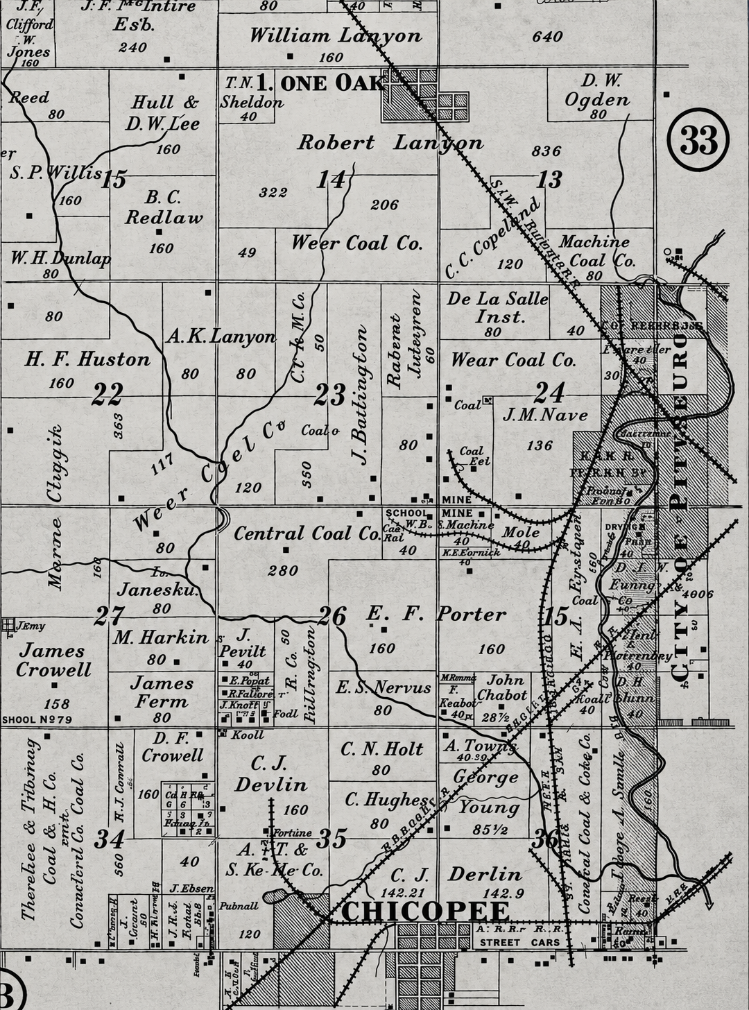
RAILROADS OF CHICOPEE and PITTSBURG
Here you can see how the railroad lines on the west side of Pittsburg. This image is the from the 1906 Plat Book of Crawford County, which can be found here: 1906crawfordt30r25.jpg (1279×1391). The line running northwesterly from Pittsburg…
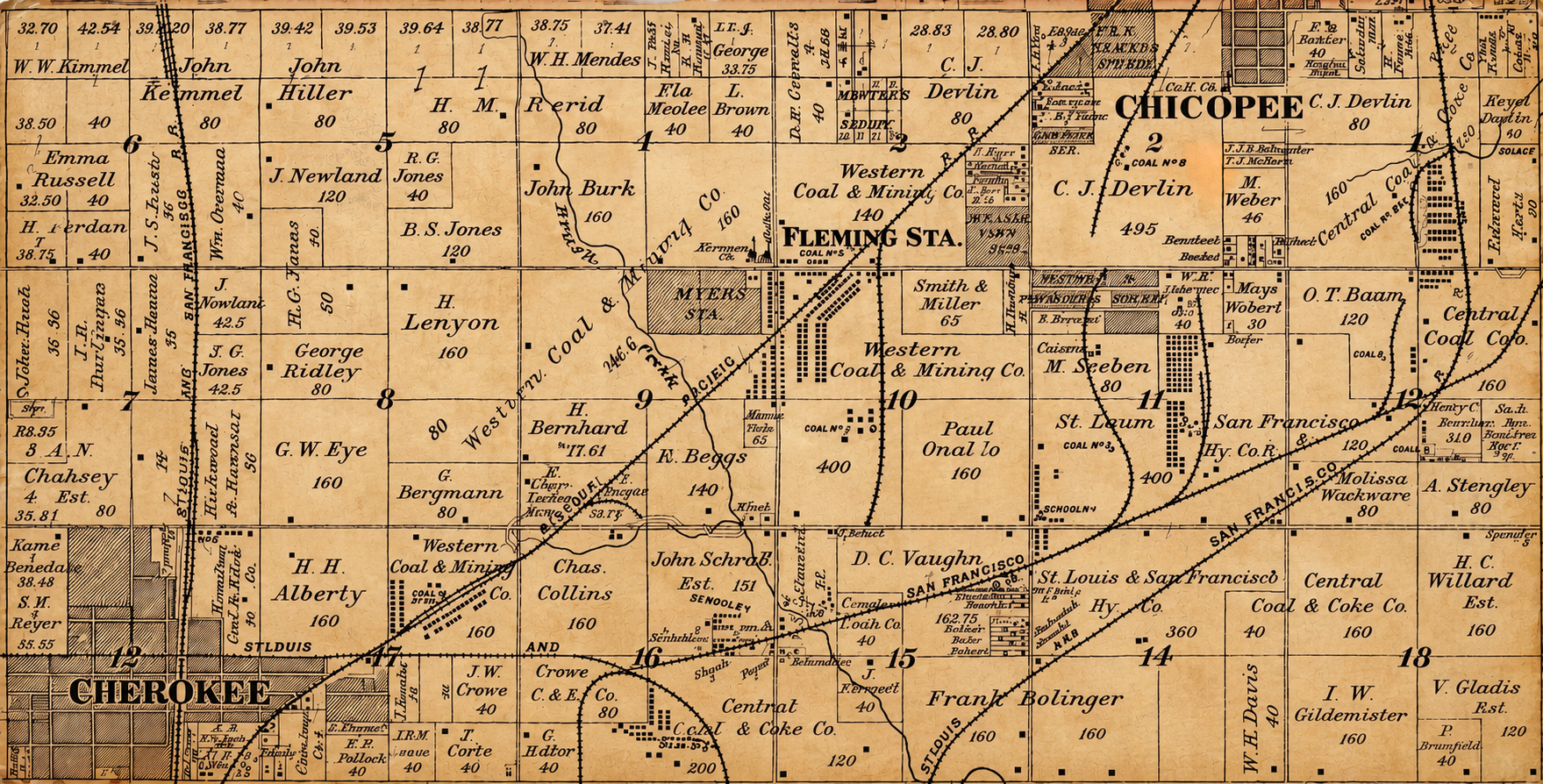
Railroads of Cherokee and Chicopee
This image is from the 1906 “Plat Book” of Crawford County. The full image can be found here: 1906crawfordt31r24.jpg (1239×813). The railroad lines appearing at the bottom of the page…
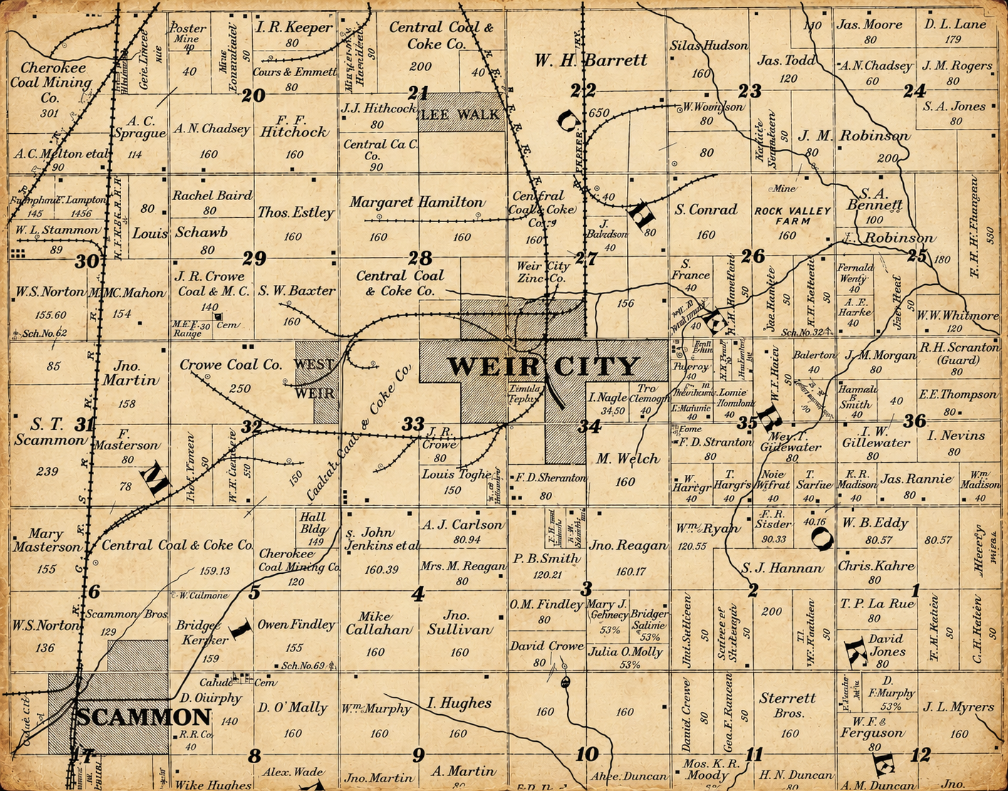
Railroads in Weir and Scammon
This image is taken from the 1902 “Plat Book” of Cherokee County. Digital copies are available online at: Kansas History and Heritage Project-Cherokee County. I cropped this image to highlight the network of railroad lines and spurs that connected Weir and Scammon. There were three active lines back then…
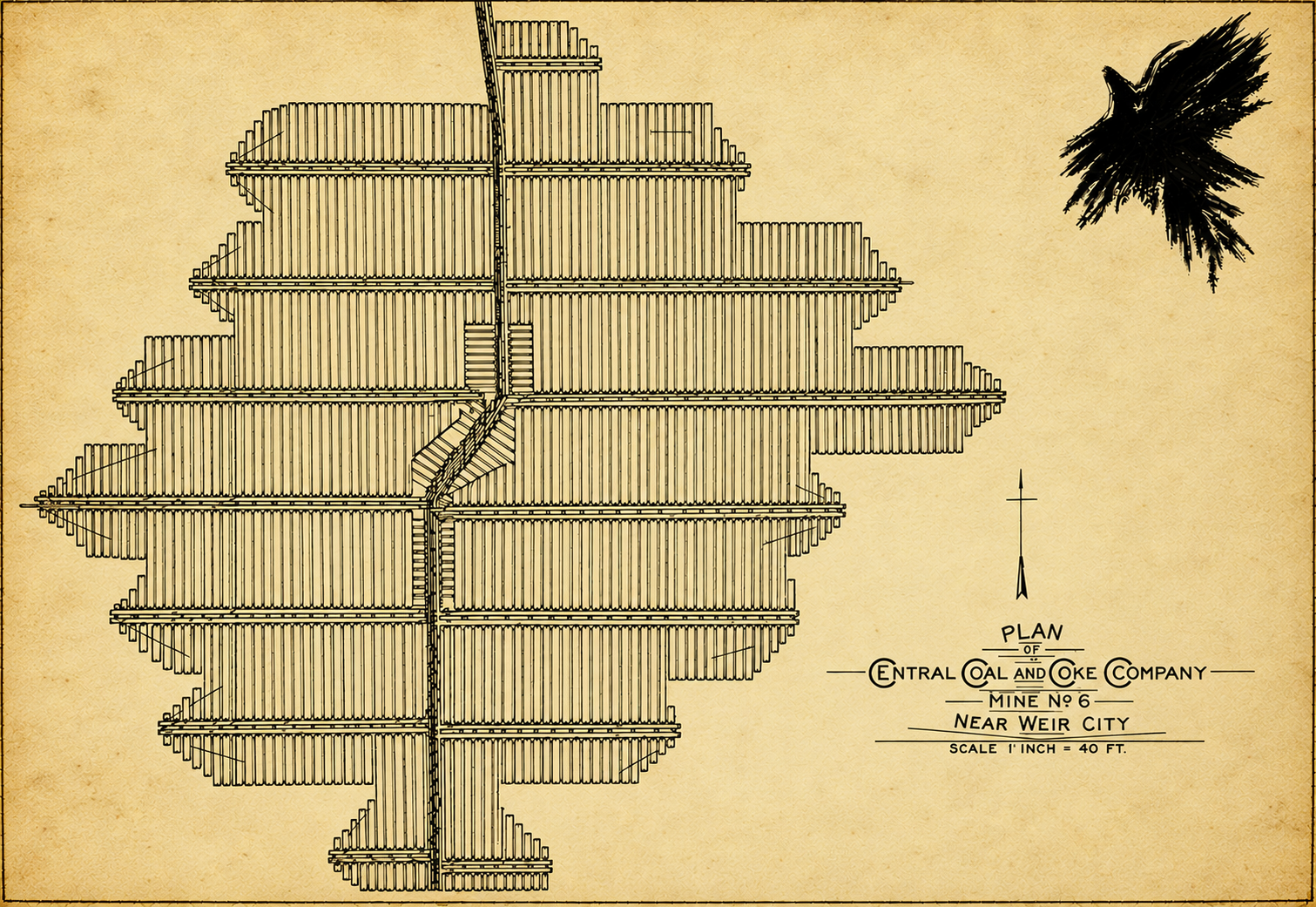
MinE No. 6 Central
Here is Mine No. 6 of Central Coal & Coke, which was located just south of Weir. It was published on page 38 of the Eighth Annual Report of the State Inspector of Coal Mines, which was was authorized by inspector Bennett Brown. Central Coal & Coke and its owner, Richard Keith, play important roles in The Crows’ Omen. This company was one of the "Big Four" that operated in the area for many years. It had mines in Weir, Scammon, and Nelson (which was east of Frontenac). Mine No. 6 was located on a spur of the Kansas City, Fort Scott & Memphis Railroad, which was later acquired by the Frisco, as explored in the story
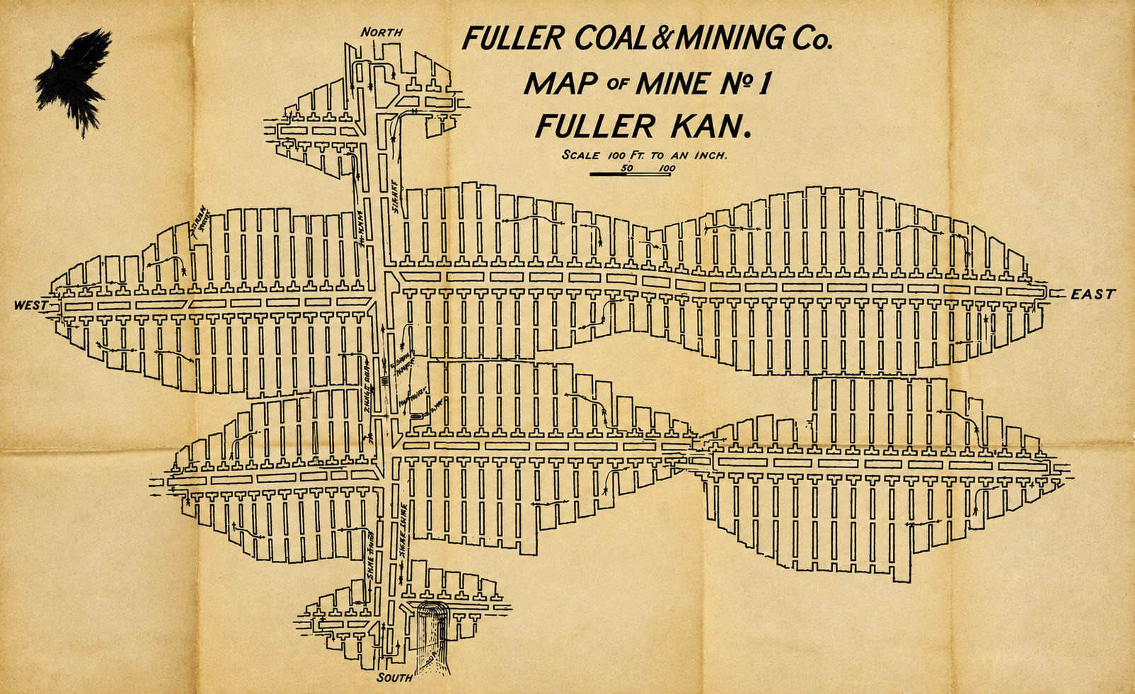
Mine No. 1 Fuller
This image shows Mine No. 1 of the Fuller Coal & Mining Company in Fuller, which was located northeast of Frontenac and south of Mulberry. It was published on pages 63 and 64 of the Eighth Annual Report of the Kansas Inspector of Mines, covering the year 1895, and was authored by Inspector of Mines Bennett Brown. The open space in the middle of the mine is likely a “horseback,” which is a geological term for an almost vertical, clay-filled fissure or crack that cuts straight through a coal seam. A horseback often rose through the floor of the coal bed, disrupting the continuous layer of coal. When confronted with a horseback, miners had no choice but to maneuver around it, as shown on this map.

Mine No. 7 Western
Mine No. 7 of the Western Coal & Mining Company was located south of Chicopee near the current location of the Countryside Golf Club. This image was published in the Tenth Annual Report of the Kansas Inspector of Mines (pages 34 and 35), authorized by Inspector George T. McGrath. This report covered the year 1897. Look how much progress the miners had made in just 3 months of work. Mine No. 7 was one of six coal mines during the strike of 1899 that had a large stockade erected to keep striking miners from harassing or interfering with the Black coal miners brought in from Alabama. The fictional Bird Dog Mine in The Crows' Omen was modeled after these coal mines.
Mine No. 5 of Mount Carmel
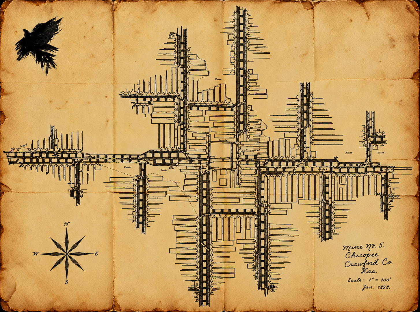
This image shows Mine No. 5 of the Mount Carmel Coal Company, located near Chicopee. It was published in the Tenth Annual Report of the Kansas Inspector of Mines, authorized by Inspector of Mines George T. McGrath. This report covered the year 1897. Mine No. 5 was the site of a significant mine explosion in 1899, in which five shot firers lost their lives. Details of the investigation can be found in the Twelfth Annual Report (1899). The published image features the name “F.O. Fogelberg, Eng.” in the lower right-hand corner, but I was unable to persuade ChatGPT to list his name correctly, so it was removed. Nevertheless, Mr. Fogelberg was clearly a skilled draftsman.
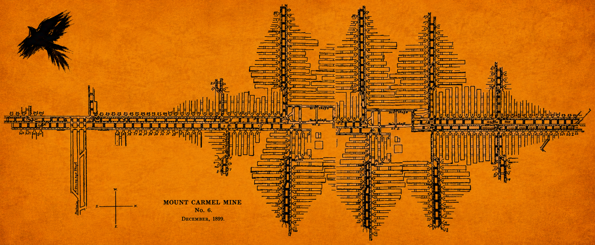
Here is the survey map of Mine No. 6 of the Mount Carmel Coal Company, which was located west of Frontenac on the Atchison, Topeka & Santa Fe Railroad (also known as the Santa Fe). This map was published on pages 96–97 of the Twelfth Annual Report of the Kansas Inspector of Mines, authored by Inspector of Mines Edward Keegan. It covered the year 1899, which aligns closely with the timeline in The Crow's Omen. I frequently referenced this report and map for ideas and inspiration.